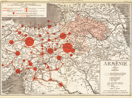
Rappor sur l'unité géographique de l'Arménie: Atlas historique
facimile of original
London: Gomidas Institute, 2000
Special Publication, duotone
12 x 16.5 inches
UK£8.00 / US$12.00
To order please contact books@gomidas.org

This classic 1920 color map of the Armenian Genocide by Zadig Khanzadian was originally printed by the Armenian National Delegation in Paris in the aftermath of the First World War (Zadig Khanzadian, Rappor sur l'unité géographique de l'Arménie: Atlas historique, [Paris: Délégation Nationale Arménienne, 1920]). It was primarily the work of engineer-cartographer Zadig Khanzadian and Aram Andonian, the latter probably the foremost expert on the Armenian Genocide at that time.
Khanzadian's map soon became an icon of the Armenian Genocide and served as a template for subsequent illustrations. Although Khanzadian's work captured the imagination of generations of Armenians (it was pathbreaking in 1920), much of its detail is now outdated and needs to be reevaluated.
This facsimile republication of Khanzadian's map, hot off the press, celebrates the 1920 work as a milestone in the historiography of the Armenian Genocide.